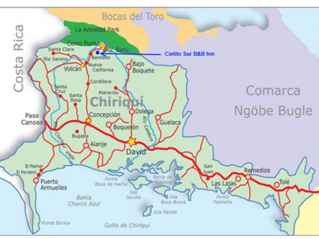
We took the double decker air conditioned bus from Panama City for $15pp (6 hours) to the city of David, the capital of the province of Chiriquí. David was a good base to hire a car and see the area. It’s also low season so discounts on places to stay.
Boca Chica
Heading East from David to Bahia de Muertos on the map above we found Boca Chica, a small fishing village on the Pacific coast. There are a number of hotels and expat homes that overlook the Gulf of Chiriqui Marine National Park.
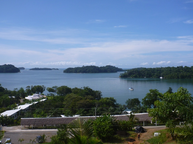
Looking out to the National Park
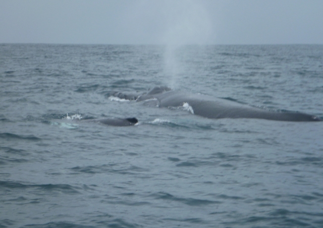
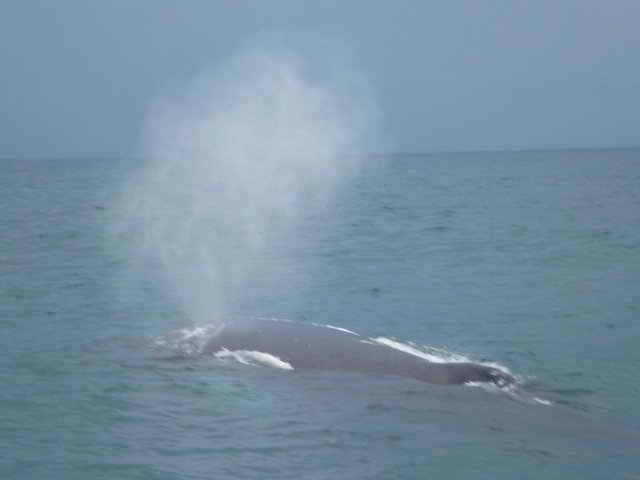
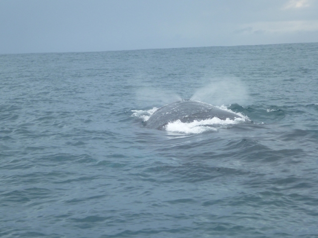
It’s humpback whale season so off we went on an excursion into the park and were not disappointed following a mother and her calf. Mum swam right beside the boat her tail was huge! Amazing, 😀.
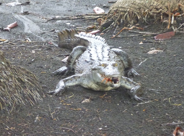
The driver surprised us by stopping at an island where we met a Ngöbe-Buglé family who look after the island and the caiman alligators that live in the lake out back; 10 of them! The island is apparently for sale at a cool US$3m.
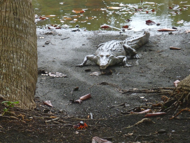
Caiman alligators love crabs see the orange crab legs at front that he has his eyes on
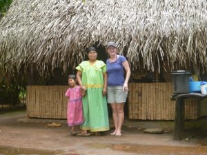
The Ngöbe-Buglé women and girls wear traditional brightly colored dresses with hand sewn appliqué to make each dress different. As you can see they are not tall people.
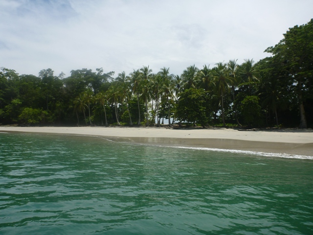
There are 25 islands in the park and we stopped at Isla Gomez with a small white sand beach with clear water so we could have a swim in the Pacific. A lot of the beaches in this area have a brown sand/ dirt.
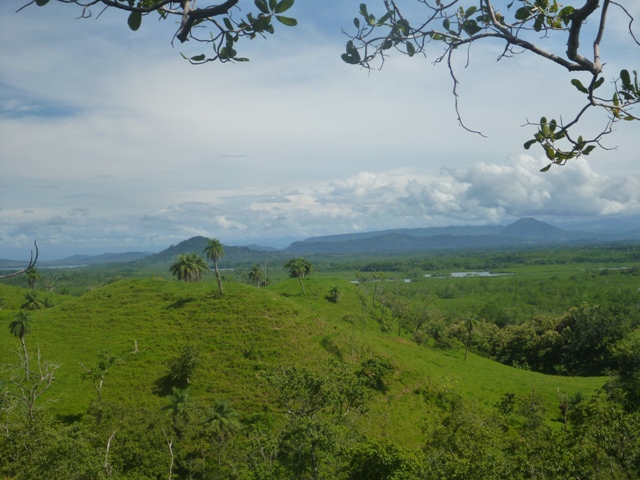
 The view from Boca Chica area back towards David and Volcan, you could clearly see the Volcanoes in the distance.
Volcan
The scenic road up to Volcan, North from David, via Dolega was a great road and very pretty, winding its way through little country villages past waterfalls and many citrus & dairy cattle farms. We found an old walking bridge across one of the many rivers we crossed.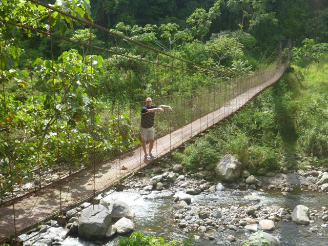
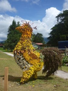
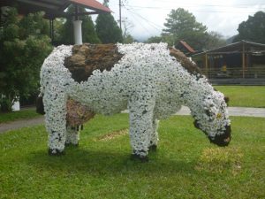
The trees were in full bloom with beautiful flowers so when we got into the town of Volcan there were lots of decorations scattered throughout town made from the flowers from a flower parade.
In Volcan we went to the Jansen Family Coffee Farm to learn about the process of making good coffee from arabica and geisha plants and are now a lot more knowledgable about something we drink every day. Emily, a family member, gave us the tour explaining their planting, harvesting, processing, roasting and packaging techniques for their award winning coffee, which is distributed throughout the world.
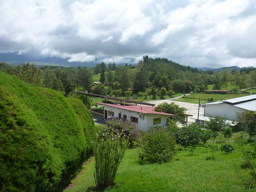
Jansen coffee farm set in a valley with views to the Volcano when not cloudy
Arabica cherries, which produce better coffee, are in bunches along a stem.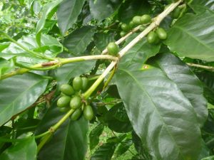 The cherries turn red when ready to pick typically in December.
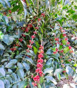
This whole region has very fertile soil because of the volcano. Most of Panama’s vegetables are grown in the area between Volcan and Cerro Punta, which is on the West side of Volcan Baru.
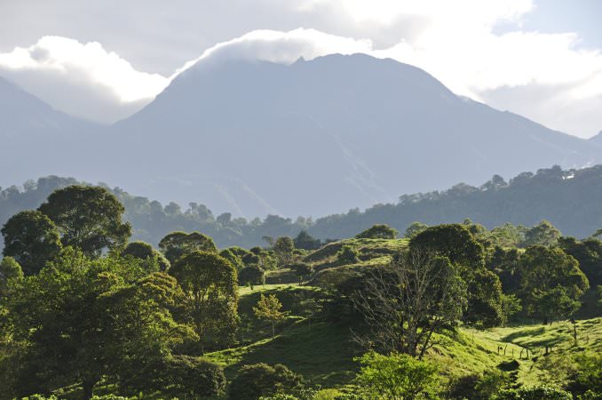
Volcan Baru
We saw hundreds of different fields of crops, trucks piled with vegetables and processing & distribution plants for fruit & vegetables. Would have been great to buy lots of fresh veg and fruit. Every inch of space is used for growing veg and this is just one small valley.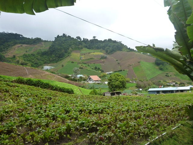
Even stopped for a walk into Cañon Macho de Monte an area that has a number of hydroelectric stations.
Guadalupe
Guadalupe is North of Volcan and Cerro Punta in the centre of the Veg growing area and close to La Amistad National Park where we hiked into the forest and ended up seeing three small waterfalls. We looked just charming in our gum boots and borrowed jackets because it was freezing up there! It’s not meant to be cold in Panama.
Puerto Armuelles
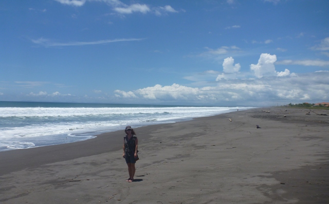
Puerto Armuelles is on a peninsular shared with Costa Rica and we’d heard there were a number of expats living there so wanted to see what all the fuss was about. Highways of course are not our style so off we went on the back roads. We stopped at a beach area called Barqueta on the coast past David that had a black “very HOT” sand beach, but alas we weren’t that impressed with it. No one was around but it did look like it got very busy given the restaurant seating around.
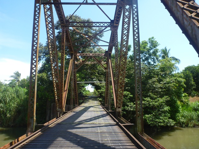
Our road trip to Puerto Armuelles continued through some agricultural lands until we were crossing through huge fincas (farms) that used to be owned by the Chiquita Banana Co and crossed railroad tie bridges. Very different passing by banana fields, oil palms, sugar cane and rice fields. I think one of the police guards after the bridge in the next picture was shocked to see tourists as he did a double take and then stopped us to see passports etc asking where we were going.
Puerto Armuelles is a town that was actually built by the Chiquita Banana Co for its workers, from executives to dock workers but when they left 25 yrs ago the population declined considerably and homes have seen better days. Expats have been buying the old Chiquita houses to fix up, life is cheap, there are English schools and the locals are friendly. A real country feel where horses share the roads even around town.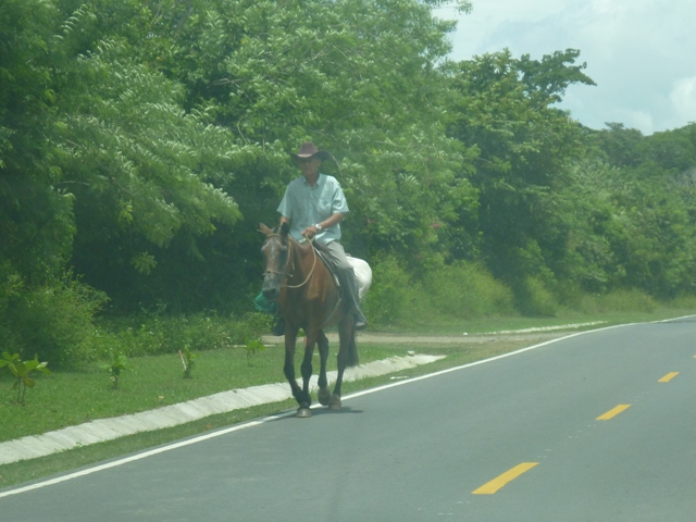
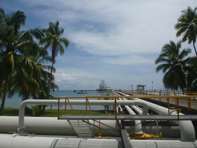
We made a trip down the peninsular and ended up going through a secure area where the Petro Terminal of Panama port is. Here oil supertankers come in to load oil via pipelines through Panama from the Atlantic side.
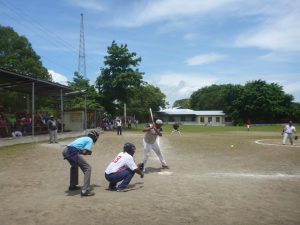
Sunday is baseball day so typically there are games on at one of the two stadiums in town so we stopped by. They have shaded bleachers and there are beer and food vendors and locals betting on teams; who are very passionate supporters, even rubbishing the umpire.
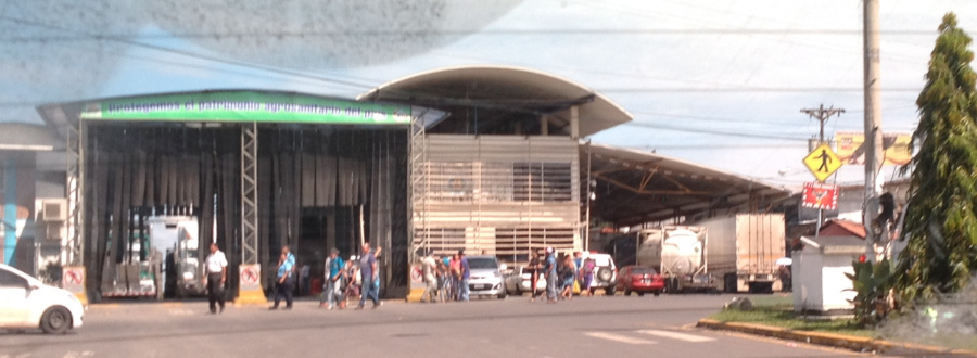
On leaving the peninsula we decided to take the highway this time, as its goes past the Costa Rican border. There is a town right on the border where Costa Rican’s and Panamanian’s shop duty free. The actual boarder is a busy place with lots of trucks lined up to go thru the agricultural spray sheds, people walking, duty free shops and cars going every which way.
Boquete
Our trip to Chiriqui ended in Boquete on the Eastern side of Volcan Baru. Boquete is a cute town set in the valley near Volcan Baru, which has lots of clouds around it in my photo.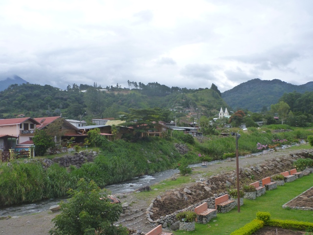
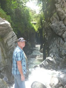
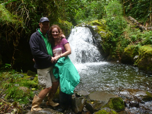
We’ve been here before and had been on a number of hikes in the area. Decided we wanted to do the hike to The Lost Waterfalls, which is in a range that just keeps going up a trail on the side of the hill and you end up seeing 3 waterfalls. Decent hike that’s for sure and very beautiful terrain.
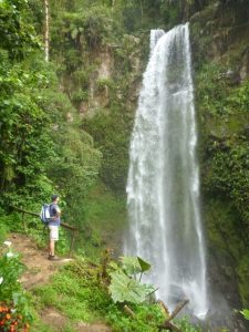
Waterfall 1, the best, which you actually see on your way back down
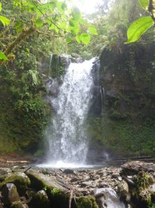
Waterfall 2, where they say you can swim in the pool at the bottom of the waterfall but the temp was a little refreshing for us.
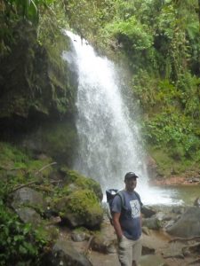
Waterfall 3 the most difficult to get to as its slippery and quite steep heading up to it.
There are even golf courses in Boquete for our golfing family and friends, you just need to choose your mode of transport around the course.
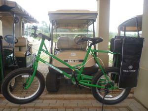
The bike maybe on not such a hilly course, but as you can see this golf course is set in the hills.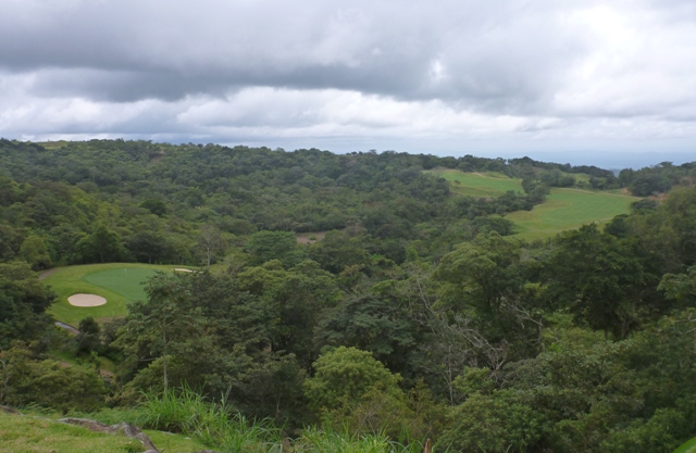
Time to head back to the boat to do some jobs and catch up with friends.